Uttaradit attractions
Attractions in Thailand
Opening days: Daily
Opening hours: 06.00 - 18.00
Phu Soi Dao National Park Originally, it was Phu Soi Dao Forest Park. Established on November 13, 1990, covering an area of 48,962.5 rai in Nam Pat District. Uttaradit Province and Chat Trakan District Phitsanulok Province.
Later, as for the National Parks, the Royal Forest Department has explored more forest areas. Ban Khok District, Nam Pat District, Uttaradit Province and Chat Trakan District Phitsanulok Province in 1994, covering an area of 125,110 rai or 199 square kilometers. to establish a Phu Soi Dao National Park.
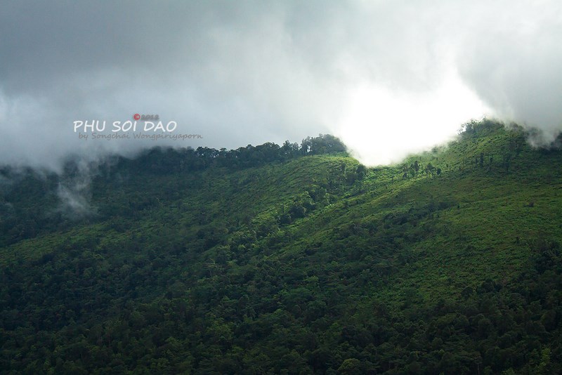
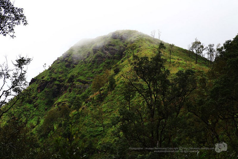
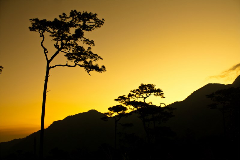
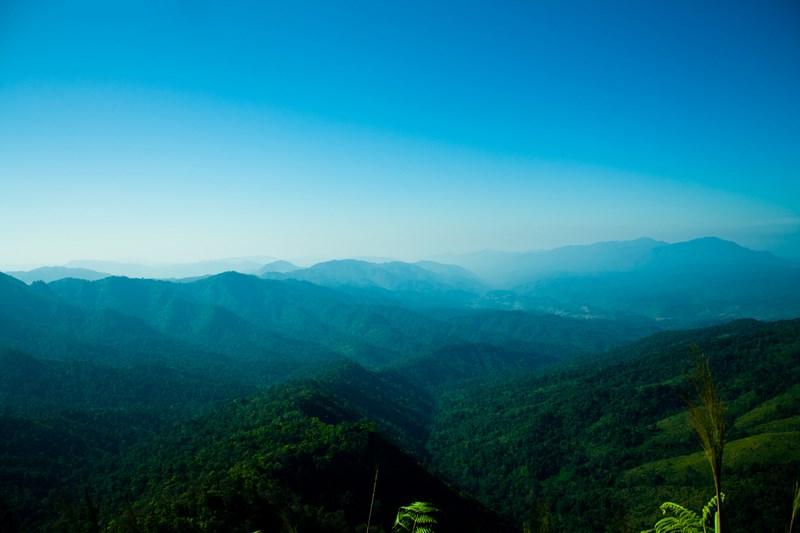
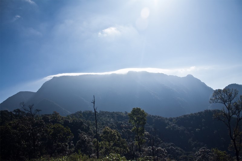
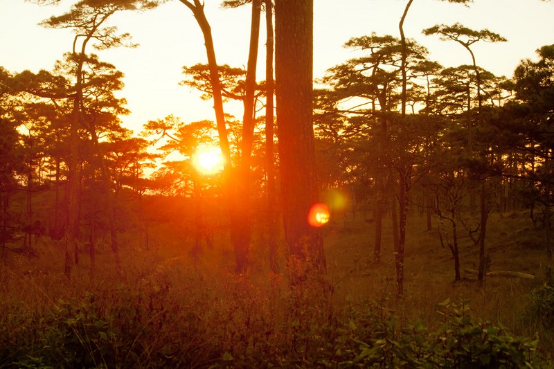
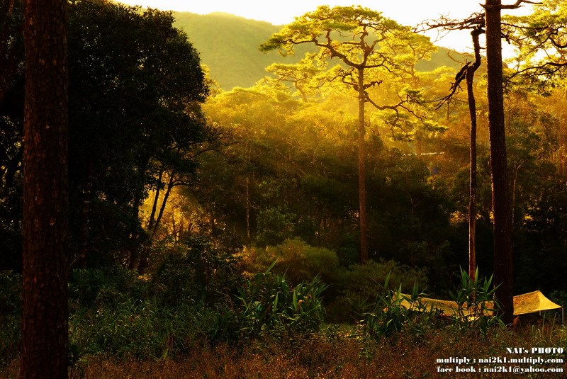
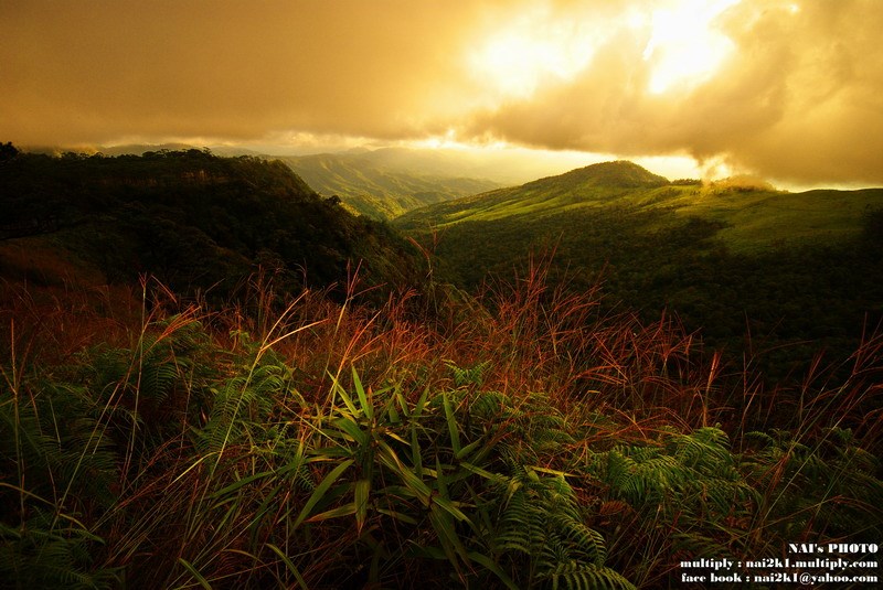
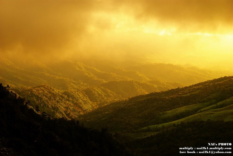
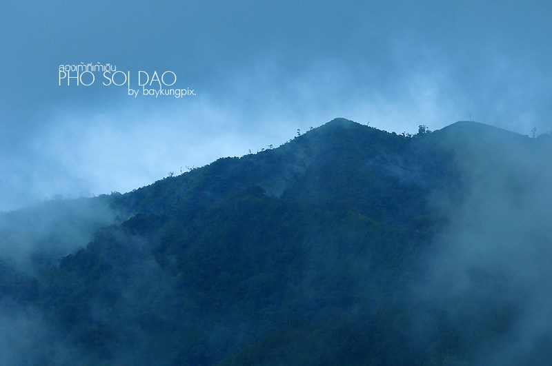
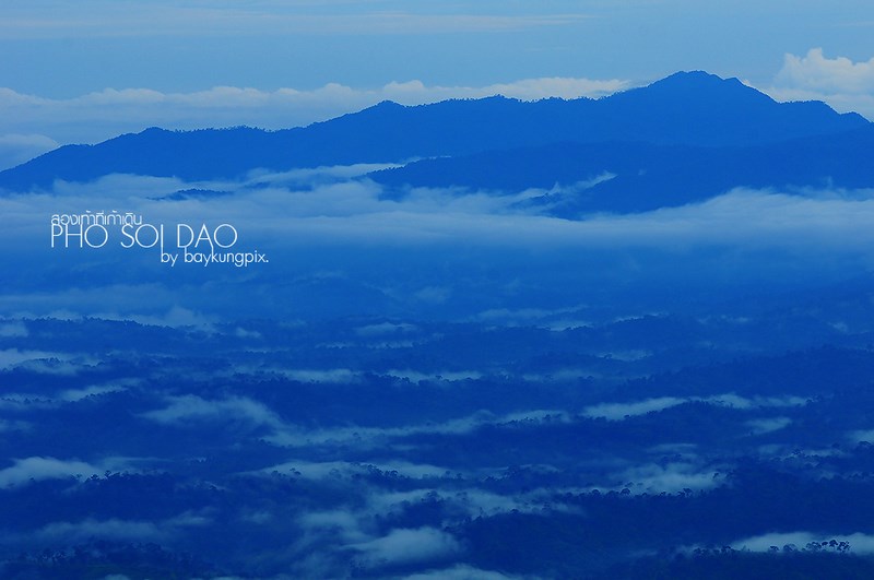
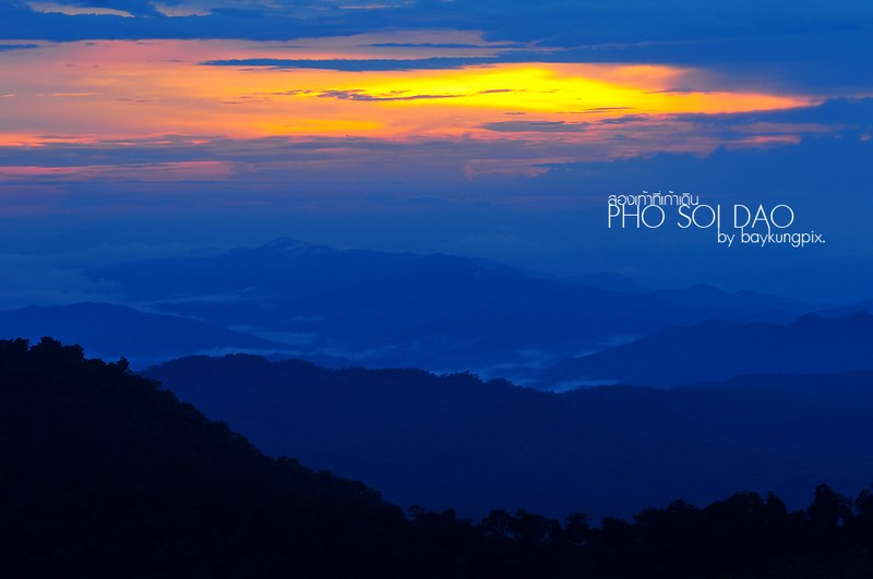
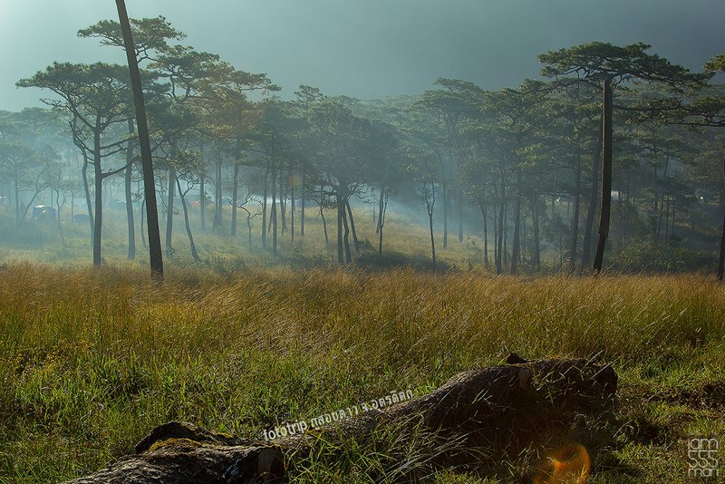
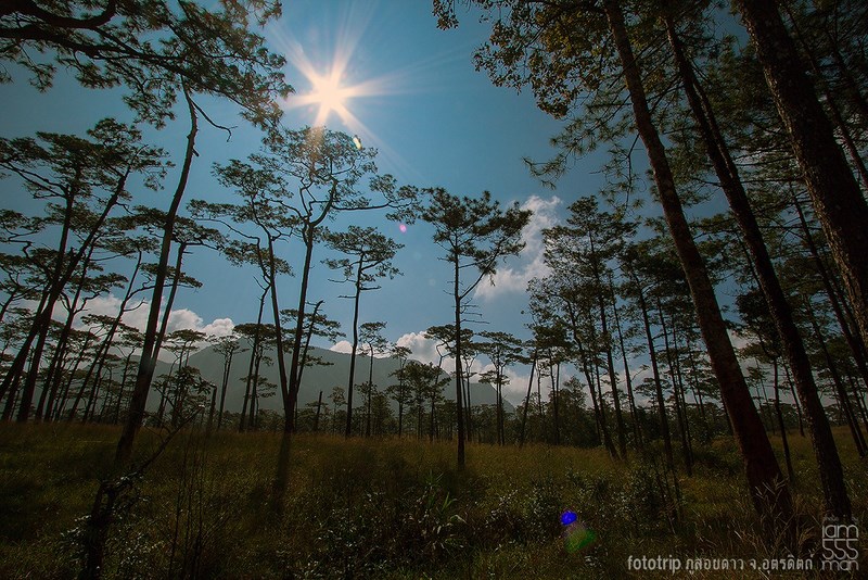
It is an area with relatively complete forest cover with beautiful natural forests. is a source of watershed The highest peak of Phu Soi Dao is 2,102 meters above sea level, which is the 5th highest in Thailand.
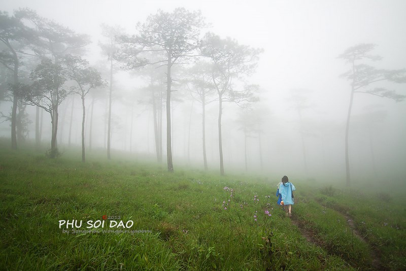
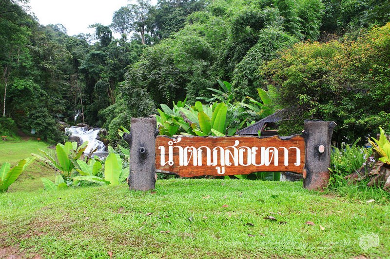
The park has some interesting and attractive features for tourists, including Phu Soi Dao Waterfall, a five-tiered waterfall, and an adventure up to the beautiful pine courtyard. It has an area of approximately 1,000 rai, is very beautiful, has paved roads to access the area, making it comfortable to travel and relax.
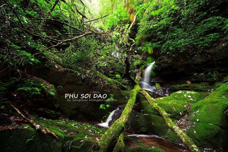
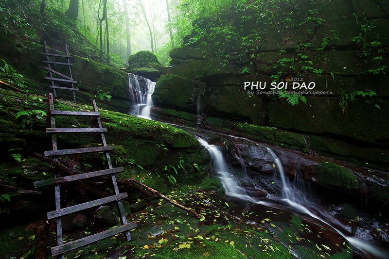
Phu Soi Dao Waterfall On the edge of National Highway No. 1268, near the National Park Office, there are a total of 5 floors, each of which is sweetly named as Phu Soi Dao, Sakaw Duan, Muean Fan, Kannikar and Supaporn, with water flowing all year round. and nearby there will be a hole waterfall
Sai Thip Waterfall It is a small waterfall with 7 tiers, each tier is about 5-10 meters high. The forest surrounding the waterfall is very humid. Therefore, green moss covered the rocks along the waterfront.
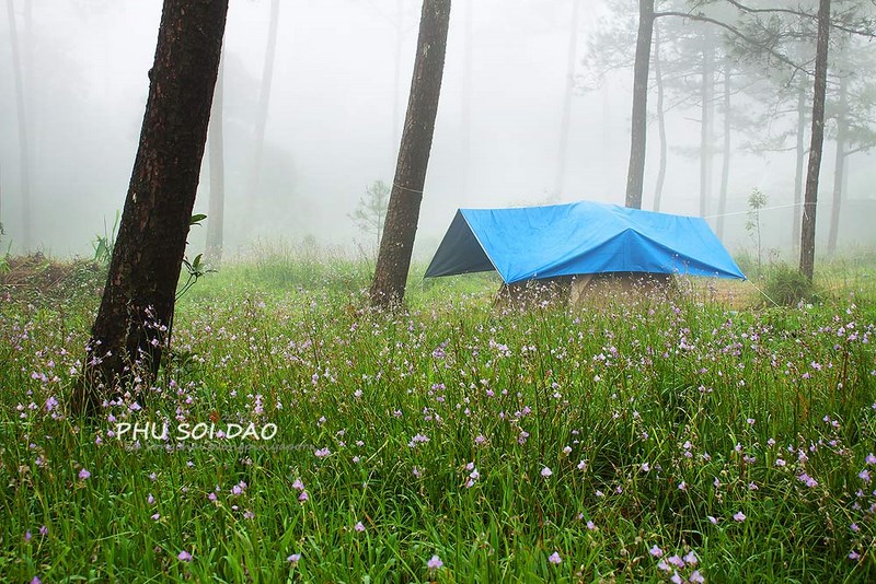
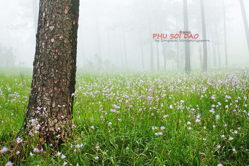
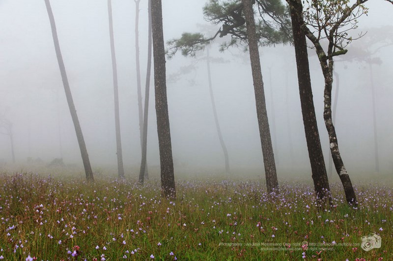
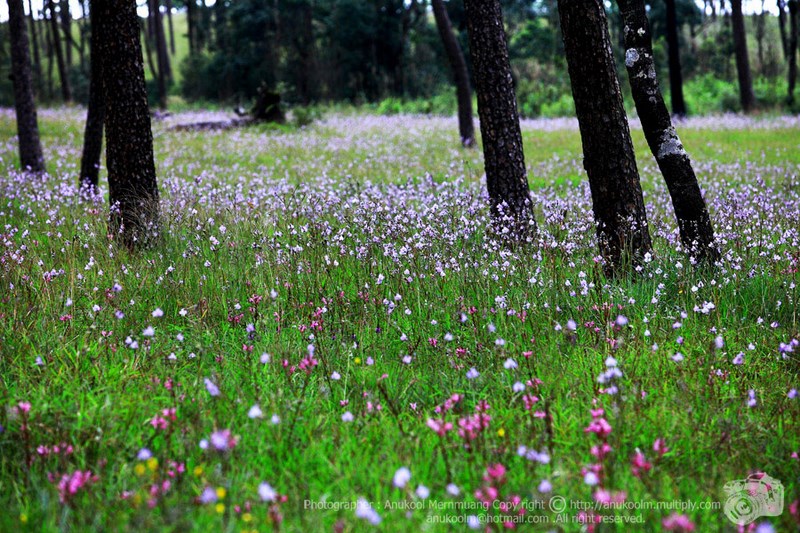
Flower fields in the pine forest during the rainy season between August and September every year. There will be soil flowers holding a bouquet of flowers in a dense group, such as Crest Nak flowers, flowers Soi Suwanna. and fragrant root grass In winter, there are silver button flowers, Naree Inthanon slipper orchids. and the maple tree, which turns red, is very beautiful
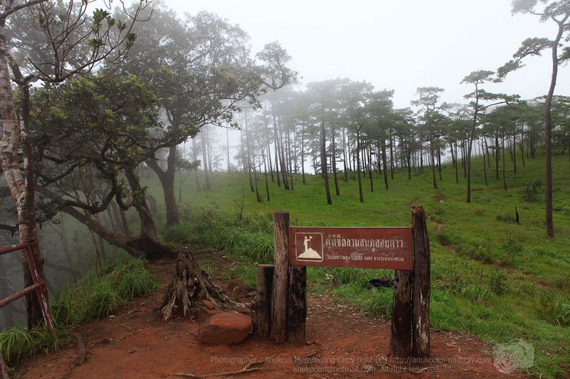
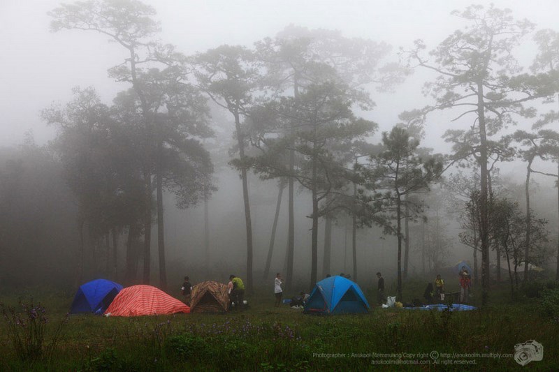
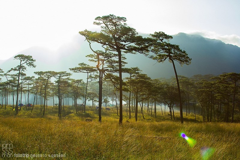
Pine Sam Bai Phu Soi Dao is a natural forest area There is an area of about 1,000 rai, which is a plain on the Phu Soi Dao mountain range. It is located approximately 1,633 meters above sea level. The condition of Lan Sam Bai is a high and low hill alternately. a pine forest The lower plant is a vast grassland. A trip to the Lan Son Sam Bai Phu Soi Dao Must travel on foot from Phu Soi Dao Waterfall along National Highway No. 1268 to the top of Phu Soi Dao, a distance of about 6.5 kilometers, takes about 4-6 hours on foot.
Thai-Laos boundary It is the boundary line demarcating the border between Thailand and Laos. After the war at Ban Rom Klao
Traveling by car, you can go on 2 routes: by car from Phitsanulok Province. Take National Highway No. 11 and turn onto National Highway No. 1246 to Ban Phae, turn onto Highway No. 1143 through Chat Trakan District. Take Highway No. 1237, pass Ban Bo Phak, to converge with the National Route No. 1268 to Phu Soi Dao Waterfall. Phu Soi Dao National Park Total distance is about 188 kilometers.
Can travel by car The distance is about 133 km by using the route. Uttaradit-Nampad (Highway No. 1047) from Uttaradit province, when reaching Nam Pat district, turn to use the car. Provincial Highway No. 1239, then drive for about 46 km. and then turn the car into the Provincial Highway No. 1268, drive about 19 kilometers and you will arrive. Phu Soi Dao National Park.


 Category:
  Group:


 Region